Map of Maryland and Virginia, John Speed (1676)
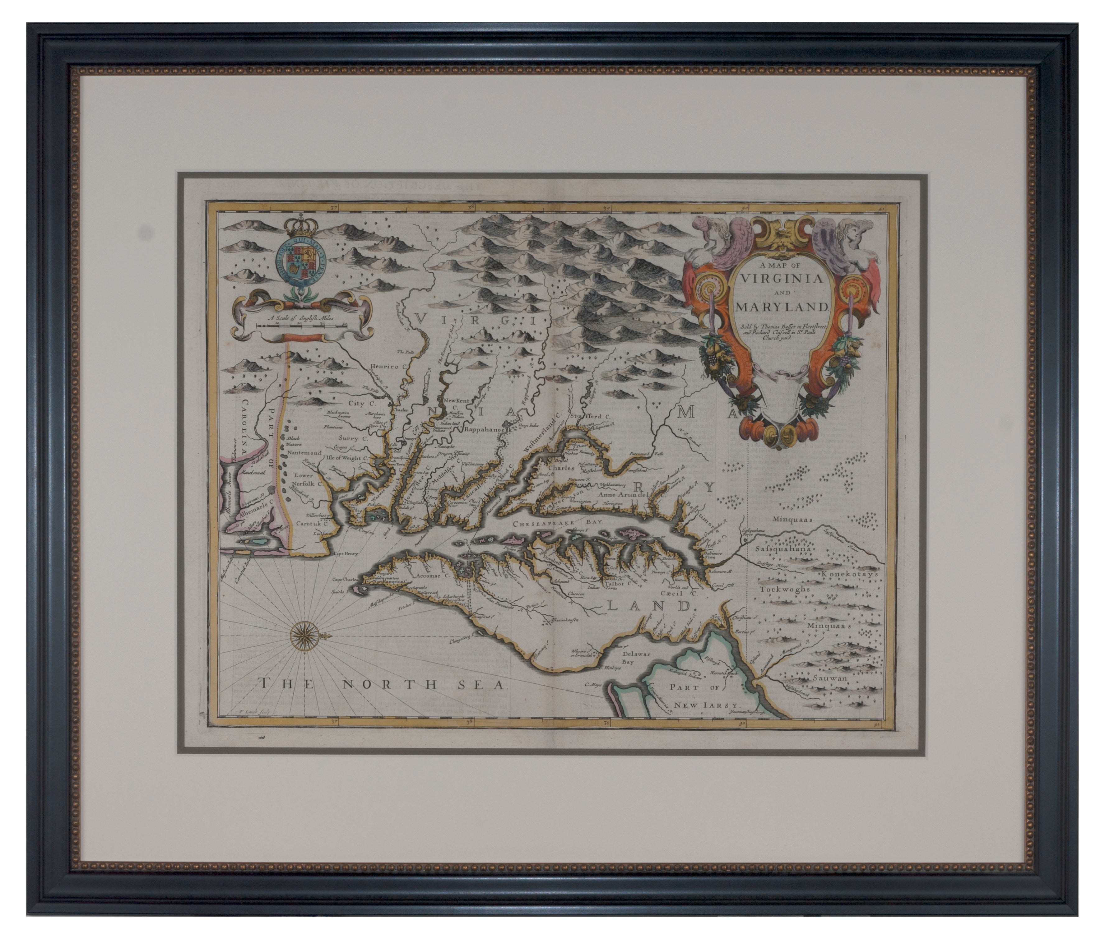
John Speed's map of Virginia and Maryland is one of the most sought after maps by either collectors of maps of either (or both) states due to the fame of the cartographer (Speed) and being an early English map of two important colonies. It wasn't until 100 years later that the colonies became, what is now, the United States of America.
This is one of the earliest English maps of the area and, perhaps the earliest to show the borders of both Virginia and Maryland. There is also text on the back of the map describing both Maryland and Virginia in great detail.
The maps names settlements and areas in English. Shown is the Chesapeake Bay and its extensive reach, the Delaware Bay and small portions of New Jersey and Carolina. Native regions and villages are depicted in known areas. Williamsburg is not mentioned even though it was founded in 1632 and originally named Middle Plantation. Jamestown, however, is named as James Town and founded in 1607. Mountain ranges are seen at the top (or to the West) and smaller ones to the northeastern area.
Unlike later maps, early colonial maps depict the North to the right. It was published by Thomas Bassett and Richard Chiswell who hired Francis Lamb to engrave the map.
A very popular and decorative map offered in reproduction by many historical living museums, libraries and traditional museums.